


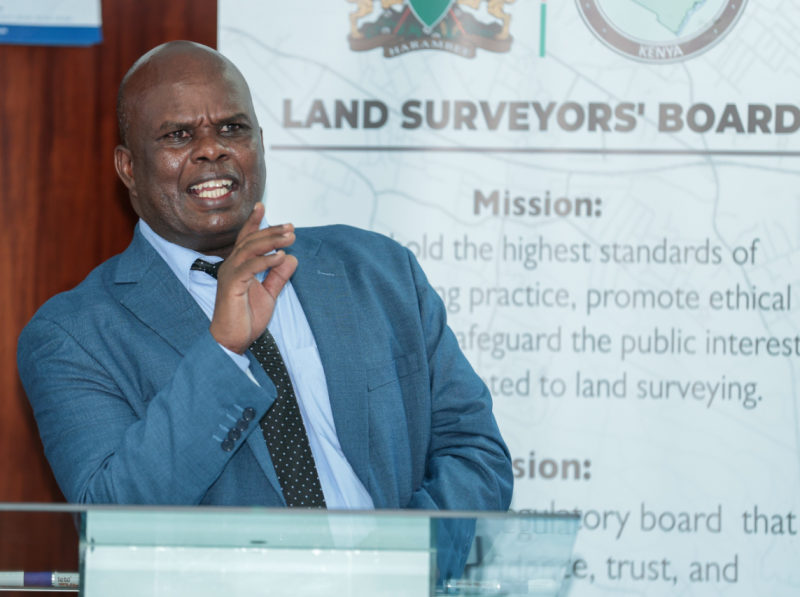
Kenya is moving to strengthen surveying and geospatial education through a proposed harmonised training framework. The framework will align university programmes with professional standards, emerging technologies and industry needs.
The initiative follows a consultative meeting between the Land Surveyors’ Board and universities offering surveying, geomatics engineering and geospatial engineering programmes. Participants agreed to harmonise academic training, clarify professional pathways and support legal and policy reforms.
Held at the Kenya School of Monetary Studies, the meeting brought together university representatives, the Kenya National Qualifications Authority (KNQA), the Council of Governors (CoG), the Director of Surveys, and members of the Land Surveyors’ Board and its Secretariat.
Surveying’s Expanding Role in National Development
Opening the meeting, Land Surveyors’ Board Chairman Maritim Weldon recognised universities’ contribution to developing Kenya’s next generation of geospatial professionals. He reaffirmed the Board’s commitment to closer collaboration with higher education institutions to strengthen professional training and standards.
Weldon noted that surveying now extends well beyond traditional land measurement and subdivision. Surveyors and geospatial specialists support land administration, infrastructure development, environmental conservation, urban planning, natural resource management and disaster risk reduction.
He emphasised that universities must equip graduates with the technical knowledge, practical competencies and professional ethics required to serve the country’s development priorities.
Weldon also highlighted the broad constitutional definition of land in Kenya, which encompasses the earth’s surface and subsurface, water bodies, marine areas, natural resources and airspace. This extensive scope reinforces the importance of surveying and geospatial engineering across multiple sectors of the economy.
Strengthening the Link Between Academic Training and Professional Registration
The discussions also highlighted the distinct but complementary responsibilities of education regulators and professional bodies.
The Commission for University Education (CUE) accredits university programmes and oversees higher education quality. Meanwhile, the Land Surveyors’ Board recognises programmes for professional registration and licensing, regulates practice and protects the public interest.
Weldon called for closer coordination between universities, regulators and industry. This would support students from admission and training through to professional registration and licensing.
Such collaboration would help graduates meet professional requirements while developing skills that address evolving industry needs.
Geospatial Technology Is Transforming the Profession
The Director of Surveys highlighted the growing role of geospatial technologies in supporting Kenya’s national development agenda.
He explained that modern surveying now underpins infrastructure planning, digital land administration, disaster preparedness, environmental management and climate resilience.
As technologies and industry applications continue to evolve, he urged universities to strengthen practical training and produce innovative, globally competitive graduates capable of addressing real-world challenges.
The discussions reinforced the need for academic programmes to keep pace with developments in surveying instruments, satellite positioning, geographic information systems (GIS), remote sensing, digital mapping and other geospatial technologies.
Universities Support a Unified Training Framework
Representing the participating universities, Dr Malachi Odongo of the Technical University of Kenya welcomed the Board’s consultative approach, describing it as an important step towards strengthening professional education.
He stressed that universities cannot develop effective curricula in isolation. Regular engagement between academic institutions, regulators and industry helps ensure that graduates acquire the competencies required by professional standards and the evolving needs of society.
This approach will also help universities respond more effectively to technological advances and changing expectations across the geospatial industry.
Universities to Develop Harmonisation Proposals
One key resolution was to harmonise university programme names in surveying, geomatics engineering and geospatial engineering.
The participating universities agreed to form an association to develop recommendations and submit them to the Land Surveyors’ Board within three months.
The Board will consider these proposals as part of ongoing legal and policy reforms to strengthen professional education, align regulation and clarify pathways into the surveying profession.
Building a Future-Ready Geospatial Profession
The proposed reforms therefore mark an important step towards strengthening collaboration between universities, professional regulators and industry stakeholders in Kenya.
Geospatial technologies are increasingly supporting infrastructure development, land administration, environmental monitoring and natural resource management. The profession therefore needs graduates with strong technical skills, practical experience and professional accountability.
In this regard, a harmonised training framework could standardise university programmes, clarify professional pathways and better prepare Kenya’s surveying and geospatial workforce for the country’s evolving needs.
Also Read:
Kenya Moves to Modernise Surveying and Geospatial Education
Why LiDAR Is Becoming Essential for Surveyors
How BIM and Surveying Are Reshaping Construction
Precision Surveying for Safer Bridges and Highways
Cybersecurity Challenges Facing Modern Surveying


