


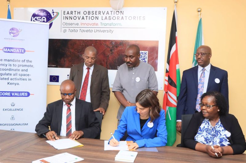
Taita Taveta County will use satellite technology to improve development planning and resource management following the launch of an Earth Observation Innovation Laboratory at Taita Taveta University in Voi. Through this facility, the county will gain access to satellite imagery, geospatial data and technical tools to support land-use monitoring, natural resource mapping, agricultural planning and infrastructure development. As a result, the initiative will strengthen the county’s ability to make informed, data-driven decisions and address local development challenges.
Satellite Technology to Improve Natural Resource Management
Taita Taveta Governor Andrew Mwadime said the technology would improve natural resource management, strengthen agricultural planning and support informed development decisions.
He added that satellite imagery would help the county identify mineral-rich areas, monitor mining activities and guide land allocation. As a result, authorities could make better-informed decisions on mineral resource management. The technology will also support agricultural planning through crop mapping, yield prediction and early warning systems.
“In agriculture, it will support crop mapping, yield prediction and early warning systems to improve planning and farmers’ support,” said Mwadime.
These applications could help county authorities identify agricultural trends, anticipate potential challenges and improve the allocation of resources to support farmers.
Geospatial Data to Support Infrastructure and Revenue Collection
Beyond agriculture and mining, the laboratory will support property mapping, urban planning, road infrastructure development and waste management.
The availability of more accurate geospatial information could also help the county improve property valuation and strengthen revenue collection by providing better information on land use, property locations and settlement patterns.
By analysing satellite images over time, government agencies can track changes in vegetation, infrastructure, land use and human settlements. This information can help authorities identify emerging development needs, monitor changes across the county and direct public resources more effectively.
Kenya Strengthens Capacity to Process Satellite Data
Kenya Space Agency Director General Maj. Gen. Hillary Kipkosgey said the laboratory would address infrastructure and technical capacity gaps that have limited the country’s ability to process and analyse satellite data for practical applications.
“The laboratory will bridge gaps in infrastructure and technical capacity needed to process and analyse satellite data,” said Kipkosgey.
In addition, the facility will bring together researchers, students, government institutions, innovators and other stakeholders to develop practical applications of Earth observation technology.
Its areas of focus will include agriculture, climate resilience, natural resource management and urban development. It will also support technical training, research and innovation, helping participants develop geospatial solutions that respond to local and national development priorities.
University Partnerships to Drive Geospatial Research and Skills
Taita Taveta University Deputy Vice-Chancellor for Administration, Finance and Planning, Prof. Kiptanui Too, said the university secured the opportunity to host the laboratory through a competitive national selection process. As a result, it emerged as one of only two successful applicants out of 18 institutions that competed to host the facility.
Through this initiative, Taita Taveta University is expected to play a central role in developing local expertise in Earth observation through research, technical training and collaboration with government agencies, private-sector organisations and other institutions.
Meanwhile, the University of Nairobi was selected as the other institution to host one of the country’s inaugural Earth Observation Innovation Laboratories.
European Partnership Supports Africa’s Geospatial Development
The initiative receives funding from the European Union and the French government under the Data Governance in Africa Initiative, through the European Union-Africa Space Partnership Programme.
Through this partnership, the programme aims to expand access to geospatial data, build technical capacity and promote locally relevant satellite technology applications.
Additionally, collaboration between universities, government agencies and other stakeholders will encourage practical use of Earth observation data to address development challenges and support sustainable growth.
For Kenya’s surveying and geospatial sector, the laboratory will also strengthen technical skills, advance research and expand the use of satellite data in land management, infrastructure planning, agriculture and natural resource management.
Also Read:
Precision Surveying for Safer Bridges and Highways
The Field of Remote Sensing: Importance and Applications
Tunisia to Pilot GIS Mapping for Public Health
Ghana Urges Surveyors to Embrace Spatial Intelligence
HOW GEOINFORMATION AT INTERGEO 2024 WILL REVOLUTIONISE GLOBAL INDUSTRIES


