


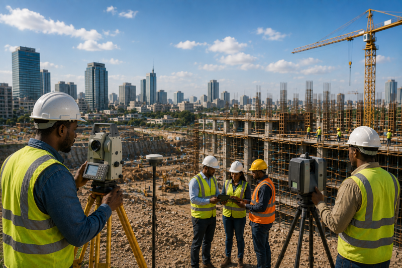
Construction is becoming more digital, data-driven and demanding. Across Africa, rapid urbanisation, infrastructure investment and expanding cities are increasing pressure on architects, engineers, contractors, surveyors and developers to deliver projects faster without sacrificing accuracy or quality.
This shift is changing the relationship between surveying and Building Information Modelling (BIM). Surveyors provide the measurements that define a project’s physical environment. BIM brings geometry, materials, systems, specifications and other project information into a coordinated digital information environment. When these capabilities work together, construction teams can make better decisions before problems reach the site.
The opportunity is significant. UN-Habitat reports that the share of Africa’s population living in urban areas increased from 15% in 1960 to 40% in 2010 and is projected to reach 60% by 2050. UN-Habitat also projects that Africa’s urban population will triple over the next 50 years, significantly transforming the region.
For the construction industry, this growth means more buildings, roads, transport systems, utilities and infrastructure to plan, design, construct and maintain. Accurate digital information will become increasingly important.
Surveying Is Becoming the Digital Foundation
Accurate understanding of the site provides the foundation for better construction decisions. Surveyors establish positions, elevations, boundaries and existing conditions that other professionals use to make design and construction decisions. BIM builds on this information.
Instead of treating survey data as a collection of isolated measurements, project teams can incorporate accurate spatial information into a coordinated digital environment. Total stations, GNSS, laser scanners, drones, photogrammetry and LiDAR can capture existing conditions and generate detailed datasets that support digital modelling.
Reality capture is particularly valuable for existing buildings and infrastructure. Laser scanning can produce dense three-dimensional point clouds that document physical conditions, while those datasets can subsequently support modelling, coordination and verification. This creates a more reliable connection between what exists physically and what appears digitally.
From Site Measurements to Intelligent Models
The value of BIM increases when survey information becomes part of a broader information-management process. A BIM model can contain geometric information alongside data about materials, components, systems and other aspects of an asset. The ISO 19650 framework recognizes BIM as an approach to managing information across the lifecycle of built assets, from planning and design through construction, operation, maintenance and eventual end-of-life.
For surveyors, this represents an important evolution. You are no longer simply delivering coordinates, drawings or point clouds. You can provide the spatial foundation that allows architects, engineers and contractors to work from a shared understanding of the project environment. That can reduce uncertainty and improve coordination.
BIM Can Help Identify Problems Before Construction
One of the strongest arguments for BIM is its ability to expose conflicts before they become expensive site problems. Imagine a building services system passing through a structural element, a drainage route conflicting with an existing utility or a proposed extension failing to match actual site dimensions. If teams discover the problem during construction, resolving it can require redesign, additional materials, labour and time. When accurate survey data feeds a coordinated BIM environment, teams can identify many spatial conflicts earlier. This does not eliminate construction risk. BIM is only as reliable as the information behind it. Poor survey control, outdated site information or incorrect modelling can still produce misleading results. That is why professional surveying remains essential.
Scan-to-BIM Is Opening New Opportunities
The combination of laser scanning and BIM is particularly valuable when teams work with existing buildings. Older structures often lack reliable digital drawings. Renovation teams may therefore spend significant time measuring rooms, structural elements, services and other features before design work begins.
A scan-to-BIM workflow can accelerate this process by capturing existing conditions digitally and converting relevant information into a usable model. Autodesk describes reality capture as a way of representing physical spaces in 3D for existing-condition assessment, planning, quality assurance and change management.
The approach is already being applied to complex infrastructure. An Autodesk University case study from São Paulo, for example, describes a scan-to-BIM workflow using terrestrial laser scanning and IFC 4.3 interoperability for underground metro infrastructure. For African survey firms, similar workflows could create opportunities in building refurbishment, transport infrastructure, industrial facilities, heritage documentation and facility management.
Construction Verification Is Becoming More Powerful
Surveying also has an important role after design. As construction progresses, survey teams can compare the physical work with the approved BIM model. This can help verify dimensions, positions, elevations and installation progress. For contractors, this provides another layer of quality control. For clients, it creates a clearer record of what was actually constructed.
Point clouds can also support as-built documentation. Instead of relying entirely on conventional drawings that may become outdated during construction, teams can maintain a more detailed digital record of completed work. Reality-capture workflows can support everything from as-built verification to installation and facilities management.
Africa’s Infrastructure Growth Makes Integration More Important
Africa’s construction environment makes the integration of surveying and BIM particularly relevant. Cities are expanding rapidly, while governments and development partners continue to invest in transport, housing, utilities and urban infrastructure. In Cameroon, for example, the World Bank approved a $200 million Sustainable Cities and Land project in 2025 to improve climate-resilient infrastructure and land administration in targeted urban areas.
Rwanda is also investing in urban mobility. The World Bank approved $100 million in financing for Kigali’s Urban Mobility Improvement Project, which includes public transport, pedestrian infrastructure, cycling facilities, electric buses and charging infrastructure.
Projects of this scale require accurate information about land, terrain, existing infrastructure and proposed assets. That creates an expanding role for surveyors who can combine traditional measurement expertise with digital workflows.
Skills Will Determine Who Benefits
Technology alone will not transform construction. Surveyors need to understand point-cloud processing, coordinate systems, data management, BIM environments, GIS integration and digital quality control. Architects and engineers need to understand how survey data enters and influences their models. Contractors need the skills to use digital information on site.
The World Bank identifies digital infrastructure, skills and access as important components of Africa’s wider digital transformation. The World Bank highlights continuing gaps in broadband access, affordability and digital skills across Africa, reinforcing the need for practical digital strategies alongside investment in technology. Construction companies therefore need practical digital strategies rather than simply purchasing software. Training, interoperability and clear information-management procedures matter just as much as hardware.
BIM Does Not Replace the Surveyor
One misconception deserves attention: BIM does not make surveying less important. The opposite can be true. The more construction depends on digital models, the more important accurate source information becomes. A BIM model built on incorrect coordinates or outdated site conditions can create problems rather than solve them. Surveyors provide the professional control that anchors digital models to physical reality. Their role is consequently evolving from measurement provider to information specialist, quality controller and digital-data manager.
From Accurate Measurements to Better Decisions
BIM and surveying are reshaping construction because they connect the physical world with a coordinated digital environment. Surveyors capture reality. BIM organizes information. Together, they give project teams a stronger basis for planning, designing, constructing and managing assets. The opportunity is particularly important for Africa as urban populations grow and infrastructure programmes become more complex.
The firms that benefit most will not necessarily be those that buy the most expensive technology. They will be those that build reliable workflows, invest in skills, maintain strong survey control and connect field data with the wider project information environment. For surveyors, this is more than a technology upgrade. It is a chance to move further upstream in the construction value chain. The future of construction will depend increasingly on the ability to turn accurate measurements into reliable digital information—and then turn that information into better decisions.
Read More:


