


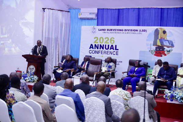
Ghana has urged land surveyors to embrace spatial intelligence and move beyond traditional measurement and mapping to improve national planning and decision-making. The call came at the 2026 Annual Conference of the Land Surveying Division (LSD) of the Ghana Institution of Surveyors (GhIS) in Accra. The conference focused on “Advancing Land Surveying through Innovation, Collaboration and Stakeholder Engagement.”
Keynote speaker Dr. Kwadwo Yeboah, Chief Executive Officer of the Land Use and Spatial Planning Authority (LUSPA), called for stronger collaboration among professionals in the built environment. He urged surveyors and other specialists to break institutional barriers, share expertise and tackle Ghana’s planning and development challenges collectively.
Dr. Yeboah also called on surveyors to take a broader role in interpreting spatial data and applying it to national development.
The President of GhIS, Surv. Emmanuel Kofi Cobbold, reaffirmed the profession’s importance to land administration, construction, spatial planning, environmental management and property rights protection.
He encouraged individual surveyors and surveying firms to strengthen their technical capabilities and professional skills to keep pace with technological developments and evolving societal needs.
Technology Is Reshaping the Surveying Profession
Chairperson of the Land Surveying Division, Surv. Ing. Dr. Tina Dzigbordi Wemegah, said modern surveyors increasingly operate at the intersection of technology, governance and community engagement. She identified AI, GNSS, UAVs, LiDAR, GIS, remote sensing and digital twins as key technologies transforming surveying and geospatial practice.
However, she stressed that technology must complement rather than replace professional judgement. Surveyors must interpret spatial data accurately, understand its wider implications and apply their expertise to support national development.
Chairman of the Conference Planning Committee, Surv. Prof. Prosper B. Laari, linked the profession’s technological transformation to some of Ghana’s persistent development challenges.
These include flooding, illegal mining, unplanned settlements, indiscriminate land sales, land disputes and growing pressure on urban infrastructure.
He explained that many of these challenges have significant spatial dimensions and therefore require reliable geospatial information, coordinated planning and responsible land governance.
Guest speaker John Asiamah also highlighted the growing importance of data and AI in transforming spatial information into actionable intelligence that supports better-informed decisions.
Ghana Strengthens Its Geospatial Infrastructure
Acting Director of the Survey and Mapping Division of the Lands Commission, Surv. Naa Abu Seidu Zakariah, outlined initiatives to modernise Ghana’s national geospatial infrastructure. In particular, she highlighted the expansion of the Continuously Operating Reference Stations (CORS) network and ongoing efforts to strengthen the country’s national geodetic reference framework.
Together, these initiatives are expected to improve the accuracy, consistency and reliability of surveying and mapping activities across the country.
Collaboration and Innovation Will Shape the Profession’s Future
The conference discussions highlighted the growing expectations placed on surveying professionals. Surveyors must go beyond mapping physical features and use spatial information to guide national development decisions.
Ghana’s surveying profession must therefore combine technological innovation with professional expertise, institutional collaboration and effective stakeholder engagement.
The 2026 conference continues with technical and paper presentations covering emerging technologies, professional practice and new approaches to geospatial development.
The programme also includes the Land Surveying Division’s Annual General Meeting, where members are expected to address key professional and institutional matters and discuss the division’s future direction.
Also Read:
Kenya Moves to Harmonise Surveying and Geospatial Training
Sustainable construction: From Cost Estimates to Green Initiatives
Kenya Moves to Modernise Surveying and Geospatial Education
Cybersecurity Challenges Facing Modern Surveying
Precision Surveying for Safer Bridges and Highways


