


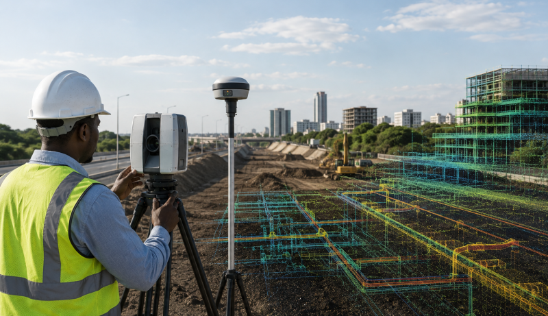
Surveying is changing rapidly. Projects are becoming larger, timelines are becoming tighter, and clients increasingly expect detailed digital information rather than conventional measurements alone. For surveyors working across Africa, these demands are particularly important as cities expand, infrastructure projects accelerate and industries such as mining, energy, construction and agriculture require increasingly accurate spatial data. This is where LiDAR technology is becoming increasingly valuable.
LiDAR, or Light Detection and Ranging, uses laser pulses to measure distances and generate highly detailed three-dimensional point clouds. Surveyors can then process these point clouds into terrain models, digital elevation models, contours, measurements and other spatial products. The U.S. Geological Survey describes LiDAR as a technology capable of producing high-resolution elevation models and explains that the collected data can be processed into bare-earth digital elevation models by removing structures and vegetation from the point cloud. For you as a surveyor, the attraction is straightforward: LiDAR allows you to capture vast amounts of spatial information about a site in a relatively short period.
More Data, More Detailed Surveys
Traditional surveying remains essential, particularly where precise control, boundary definition and measurements with legal or regulatory significance are required. However, conventional methods can become challenging when you need to capture large, complex or difficult-to-access areas. LiDAR changes the equation by capturing millions of individual measurements on many survey projects.
Rather than relying solely on selected measurement points, you can create a dense three-dimensional representation of the environment. That point cloud can reveal terrain, buildings, vegetation, roads, drainage features and other physical characteristics. The result is not simply a collection of measurements. It is a detailed digital representation that you can analyse from different perspectives. For large infrastructure, mining or engineering projects, this information can provide a much stronger foundation for design, planning and monitoring.
Speed Is Becoming a Major Advantage
Time has become one of the most important considerations in professional surveying. Clients want accurate results without unnecessary delays. Survey firms also need to complete projects efficiently while controlling labour and equipment costs. LiDAR can help survey teams capture extensive areas quickly, particularly when deployed from aircraft, drones or mobile mapping platforms. The technology is therefore well suited to projects where collecting large quantities of spatial information through conventional field methods could take considerable time.
However, LiDAR should not be viewed simply as a replacement for traditional surveying. The strongest workflows combine technologies. Surveyors can establish accurate control using GNSS and other conventional techniques, capture detailed site information with LiDAR and then use appropriate software to process, classify and validate the resulting point cloud. This combination allows professional judgement to remain at the centre of the workflow.
LiDAR Delivers Three-Dimensional Information
One of LiDAR’s greatest advantages is its ability to capture three-dimensional information. For surveyors, that opens opportunities across numerous applications. You can use LiDAR to model terrain, assess earthworks, calculate stockpile volumes, monitor road conditions, document structures and support infrastructure design.
The technology is also valuable when a project requires an understanding of elevation and surface characteristics rather than simply horizontal position. The USGS uses and provides topographic LiDAR data for applications ranging from mapping landforms to supporting geological and natural-resource assessments. Its national 3D Elevation Program demonstrates how LiDAR-derived elevation data can support large-scale geospatial analysis and decision-making.
Africa’s Infrastructure Boom Creates New Opportunities
Across Africa, infrastructure development is creating a growing need for reliable geospatial information. Roads, railways, airports, ports, housing developments, industrial facilities, power projects and urban expansion all depend on accurate information about the physical environment.
The World Bank increasingly recognizes the value of geospatial information in development planning and infrastructure projects, particularly where location-based data can support planning, monitoring and decision-making. Its geospatial programmes combine technologies including satellite imagery, drones and other spatial datasets to support planning and project monitoring. For African surveyors, this creates an opportunity to move beyond conventional data collection and become strategic providers of three-dimensional information.
Mining and Energy Can Benefit Significantly
Mining companies need accurate information about terrain, pits, stockpiles, haul roads and surrounding infrastructure. LiDAR can support these requirements by generating detailed three-dimensional datasets that surveyors can analyse and compare over time. The same principle applies to energy projects.
When planning transmission lines, renewable-energy installations, pipelines or other infrastructure, project teams need reliable information about terrain and existing features. LiDAR can help surveyors capture this information efficiently and create detailed datasets for engineers, planners and environmental specialists. Its value increases further when projects require repeated monitoring. Comparing datasets collected at different times can help identify changes in terrain, excavation, construction progress or infrastructure condition.
LiDAR Extends Surveying into Challenging Terrain
Africa’s diverse landscapes can present significant challenges for field teams. Dense vegetation, steep terrain, expansive construction sites and remote locations can make conventional data collection difficult and time-consuming. LiDAR can provide an important advantage because laser pulses can capture three-dimensional information across complex environments.
However, you should not assume that LiDAR automatically solves every visibility problem. Vegetation density, sensor configuration, flight parameters, terrain and data-processing methods all influence the final result. Accuracy also requires careful quality control. The USGS notes that LiDAR accuracy assessments use ground control points and other methods to evaluate positional and vertical performance. For professional surveyors, therefore, the technology is only as good as the acquisition, control, processing and validation behind it.
The Real Value Is in the Data
Buying a LiDAR sensor is not the same as becoming a LiDAR surveying specialist. The real value comes from knowing how to design a survey, establish appropriate control, select the right platform and sensor, manage acquisition parameters, process point clouds and validate results.
You also need the ability to turn raw data into useful deliverables. A client may not want millions of points. They may need a terrain model, contours, cross-sections, volume calculations, CAD linework or a monitoring report. That is where professional surveying expertise remains essential.
LiDAR Is Strengthening the Surveyor’s Role
Some professionals initially viewed automation and remote sensing as threats to traditional surveying. In reality, technologies such as LiDAR can strengthen the surveyor’s role by allowing professionals to manage larger datasets and provide more sophisticated analysis The surveyor increasingly becomes the professional who connects field measurement, geospatial technology, quality control and practical decision-making. That shift creates opportunities for firms willing to invest in equipment, software and technical training.
From Point Clouds to Strategic Insight
LiDAR is becoming important not because it makes traditional surveying obsolete, but because modern projects demand more information, greater efficiency and increasingly sophisticated three-dimensional data. For African surveyors, the opportunity is particularly significant. Infrastructure development, urbanisation, mining, energy and environmental management all require accurate spatial information.
The firms that succeed will not necessarily be those that simply own the most advanced equipment. They will be those that know how to apply LiDAR intelligently, integrate it with GNSS, drones, GIS and conventional surveying, and turn complex point clouds into information clients can use. LiDAR is therefore more than a scanning technology. It is becoming a strategic surveying capability—one that can help you capture more information, work more efficiently and deliver greater value in Africa’s increasingly data-driven built environment.
For technical background on how LiDAR produces elevation models and point-cloud data, the U.S. Geological Survey’s LiDAR overview provides a useful reference.
Read More:


