


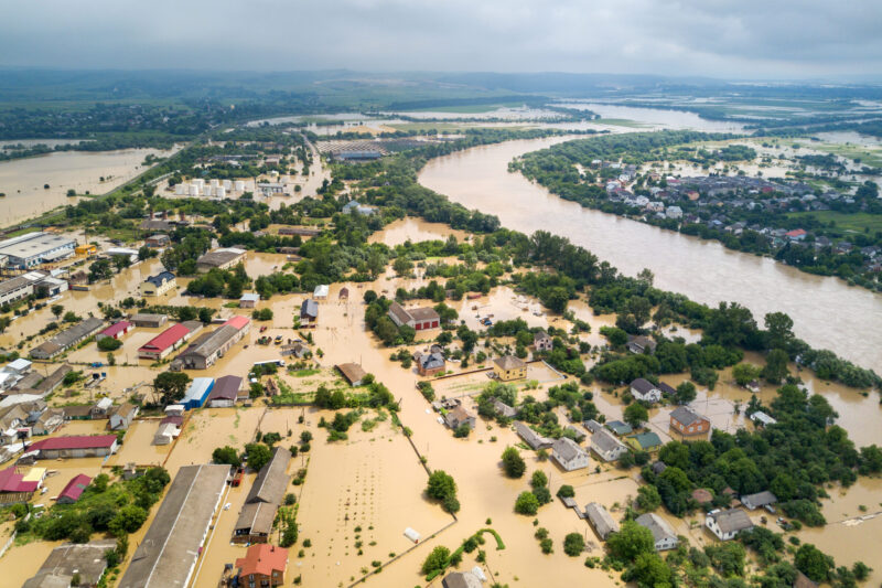
Climate change poses a significant threat to our planet. The rising sea levels are one of its most visible and impactful consequences. As the world’s oceans continue to swell, the role of marine surveying in understanding and adapting to these changes has never been more essential. Climate change and global warming are real. In fact, they are causing water levels to rise. This rise in water levels poses a serious threat to river, dam and coastal areas in Africa.
Climate change refers to long-term changes in temperature, precipitation, and other atmospheric conditions on Earth. Global warming, a major driver of climate change, is primarily caused by human activities such as burning fossil fuels and deforestation. These activities release greenhouse gases like carbon dioxide into the atmosphere. As a result, these gases trap heat and cause the planet to warm up.
Impact of Climate Change on Rising Sea Levels
The impact of climate change on rising sea levels is profound. Coastal erosion, increased flooding, and saltwater intrusion into freshwater sources are just a few of the consequences. The need to adapt and mitigate these effects is crucial for the survival of water area communities and ecosystems.
Importance of Marine Surveying in Climate Change Resilience
Marine surveying plays a vital role in understanding and adapting to the changes brought about by climate change. By collecting accurate data on sea levels, coastal erosion, and marine ecosystems, surveyors provide valuable insights. These insights help in developing effective strategies for climate change resilience.
Also Read: Surveyors urged to Mitigate Climate Change
Role of Marine Surveying in Understanding Environmental Changes
Marine surveying helps in monitoring changes in sea levels, coastal morphology, and marine biodiversity. By studying these changes over time, surveyors can assess the impact of climate change and make informed decisions to protect water areas and marine ecosystems.
Significance of Accurate Data Collection for Climate Change Adaptation
Accurate data collection is essential for effective climate change adaptation. Marine surveyors use advanced technologies to collect precise measurements of sea levels, water quality, and marine habitats. This data is crucial for developing strategies to protect coastal communities and ecosystems from the impacts of rising sea levels.
Challenges Faced by Marine Surveyors in Adapting to Rising Sea Levels
Despite the importance of their work, marine surveyors face several challenges in adapting to rising sea levels. Technological limitations, financial constraints, and resource allocation issues can hinder their efforts to monitor and mitigate the impacts of climate change on coastal areas.
Technological Limitations in Monitoring Rising Sea Levels
Monitoring rising sea levels requires sophisticated technologies and equipment. However, many marine surveyors face limitations in accessing and utilizing these tools effectively. Improvements in technology are needed to enhance the accuracy and efficiency of sea level monitoring efforts.
Financial Constraints and Resource Allocation for Marine Surveying
Securing funding for marine surveying projects can be a significant challenge. Limited resources and competing priorities often result in inadequate funding for essential data collection and monitoring activities. Furthermore, addressing these financial constraints is crucial for ensuring the resilience of coastal and water area communities in the face of rising sea levels.
Innovations and Technologies for Marine Surveying in a Changing Climate
To overcome the challenges posed by climate change, marine surveyors are turning to innovative technologies and approaches. Remote sensing, Geographic Information Systems (GIS) applications, and autonomous underwater vehicles (AUVs) are revolutionizing the way data is collected and analyzed in marine environments.
Remote Sensing and Geographic Information Systems (GIS) Applications
Technologies, such as satellite imagery and aerial surveys, provide valuable data for monitoring changes in coastal areas and marine ecosystems. GIS applications help in analyzing and visualizing this data, enabling marine surveyors to make informed decisions for climate change adaptation.
Advancements in Autonomous Underwater Vehicles (AUVs) for Data Collection
Autonomous underwater vehicles (AUVs) are reforming data collection in marine environments. These unmanned vehicles can collect high-resolution data on sea levels, water quality, and marine biodiversity autonomously. Advancements in AUV technology are enhancing the efficiency and accuracy of marine surveying efforts in a changing climate.
Engagement with Local Communities and Stakeholders in Surveying Initiatives
In the world of marine surveying, building relationships with local communities and stakeholders is key to success. Engaging with these groups helps ensure that surveying initiatives are not only effective but also respectful of the environment and the people who depend on it. By involving local communities in the decision-making process, surveyors can tap into valuable knowledge. Hence, surveyors can ensure that their work aligns with community needs and priorities.
Sharing Best Practices and Lessons Learned Among Marine Surveying Professionals
Exchanging knowledge and lessons learned in the field, can collectively raise the bar for sustainable surveying practices. Whether it’s discussing innovative techniques, new technologies, or successful case studies, the sharing of information can benefit everyone involved in marine surveying and contribute to more resilient and effective surveying efforts.
Government Policies Supporting Climate Resilience in Marine Surveying
Government policies play a decisive role when it comes to addressing climate change in marine surveying. Policies that support climate resilience can help guide surveying efforts in a direction that prioritizes sustainability and adaptation. By creating frameworks that promote eco-friendly practices and advocate for the protection of marine ecosystems, governments can incentivize climate-conscious behavior. This way, governments make a significant impact on the future of marine surveying in the face of climate change.
International Agreements and Standards for Climate Change Mitigation in Marine Environments
Climate change knows no borders, which is why international cooperation is essential in mitigating its effects on marine environments. Through agreements and standards that promote environmental stewardship, collaboration, and shared responsibility, countries can work together. By doing so, they address the challenges posed by climate change in marine surveying. By setting common goals and guidelines, the global community can strive towards a more sustainable and resilient future for our oceans and water resources.
Building a Resilient Future for Marine Surveying in the Face of Climate Change
As the effects of climate change continue to unfold, the importance of building a resilient future for marine surveying cannot be overstated. By embracing collaborative approaches, sharing best practices, and adhering to sound policies, surveying professionals can adapt to rising sea levels. They can also adapt to other climate-related challenges by learning from successful case studies. Through innovation, cooperation, and a commitment to sustainability, the field of marine surveying can navigate uncharted waters with confidence. It can also contribute to a brighter future for our water resources and planet.
The impact of climate change on marine surveying is undeniable, however, by embracing innovation, collaboration, and best practices, we can navigate these challenges. Hence, we build a more resilient future for our oceans. As we continue to adapt and evolve in the face of rising sea levels, it is essential that we prioritize sustainable approaches. In addition, we must leverage the power of data and technology to safeguard our water resources for generations to come. Together, we can work towards a more sustainable and climate-resilient future for marine surveying.
Also Read:
Hydrographic Survey Offshore Energy Exploration
By Dorcas Kang'ereha


