


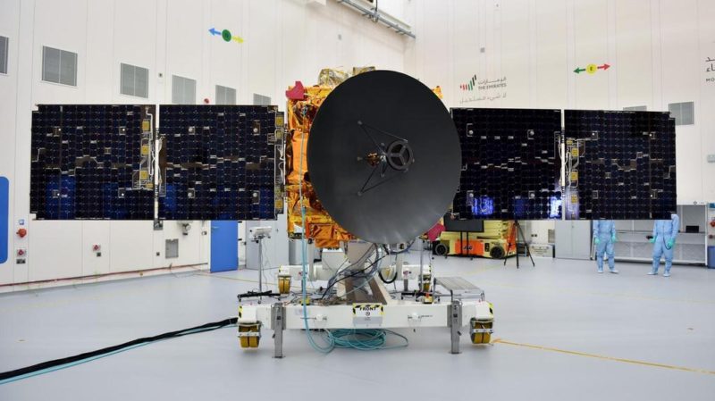
The United Arab Emirates is set to launch a navigation satellite next year. The satellite will aim to demonstrate the country’s technological capabilities. This is according to Emirates News Agency (WAM).
“The National Space Science and Technology Centre (NSSTC) at UAE University in Al Ain will launch the first satellite in 2021, followed by a technologically enhanced second satellite the next year,” said Dr. Khaled Al Hashmi, Director of NSSTC.
Navigation satellites provide positioning signals for car navigation systems and smartphones, which people use worldwide. These systems rely on satellite signals to determine a user’s current location. In addition, navigation services support surveying, disaster prevention, and various other applications.
The UAE will develop its navigation satellite through the Satellite Assembly, Integration, and Testing (AIT) Centre. Tawazun Economic Council and Airbus established this collaboration in partnership with NSSTC, Al Hashmi explained.
“The satellite project funded by the UAE Space Agency aims for technology demonstration and capability build-up, and not meant for adding a navigation system immediately. We try to select a certain technology, design and develop the satellite and payload here. In addition, we will own the intellectually property rights.
“And if we are successful, the project can be expanded further,” explained the director of the NSSTC, which was jointly established by UAE University in Al Ain, the UAE Space Agency and the Telecommunications Regulatory Authority (ICT-Fund).
No replacement for global systems
The new satellite is not aimed at replacing any existing Global Navigation Satellite Systems, GNSS, the director clarified.
“For us, it is a project to develop local capabilities in designing and building the satellite and payload. It is an initial work and several other countries are also trying to develop similar technologies,” Al Hashmi noted.
New entrants to global navigation systems
About the relevance of more countries developing the navigation satellite systems, he said if one existing system does not work, the world can depend on another one. Additionally, operators can use it for other purposes, such as deploying drones.
Currently, four Global Navigation Satellite Systems operate worldwide: the United States’ Global Positioning System (GPS), Russia’s GLONASS, the European Union’s Galileo, and China’s BeiDou. Two regional systems also operate: Japan’s Quasi-Zenith Satellite System (QZSS) and India’s Regional Navigation Satellite System (IRNSS), which later received the operational name Navigation with Indian Constellation (NavIC).

Hope Probe supports new projects
The UAE’s navigation satellite project is part of Science and Technology Roadmap created by the UAE Space Agency and the NSSTC on developing new technologies, Al Hashmi explained. “It is a research project as well. We want to learn how to develop such a technology.”
The UAE’s Mars Mission, Hope Probe, has contributed to the establishment of the Satellite Assembly, Integration and Testing, AIT, Centre, he said.
“The talks about this has been going on for two years and a deal was reached soon after the successful launch of the Hope Probe, which has opened new opportunities of collaboration between the UAE and global space agencies and companies,” the official noted.
Arab satellite 813
The second project of the AIT Centre is development of 813, the Arab Satellite. This initiative was announced by His Highness Sheikh Mohammed bin Rashid Al Maktoum, Vice President, Prime Minister and Ruler of Dubai.
“We have almost completed its first phase called the mission concept,” Al Hashmi said.
“The initial configuration of the satellite, which will soon move to the second phase, have already constituted the local team. Furthermore, we are selecting partners from other Arab countries participating in the project,” he revealed.
The UAE initiated the creation of the first Arab Space Coordination Group in 2019 along with 10 Arab nations. The group will develop 813, an advanced satellite funded by the UAE Space Agency to monitor earth, environment and climate.
The name 813 refers to the date that marked the beginning of prosperity for the House of Wisdom in Baghdad under the reign of Al-Ma’mun.
Climate change research
The Hope Probe, which took off from Japan’s Tanegashima Space Centre on 20th July, is staying healthy on its course. The Mohammed Bin Rashid Space Centre, MBRSC, in Dubai is receiving signals as per the expectations, the official revealed.
“We thank the UAE leadership for their support to the space sector. The leadership and other stakeholders in the government have realised that space is a gateway to all sciences. In fact, one mission to deep space needs participation of scientists and engineers in many disciplines.
“This means more people join science and technology sector. Therefore, space missions will raise hopes about future of science and technology in the county and region, Al Hashmi said.
Courtesy: Spacewatch
Read More:
UAE using Drones and AI to map desert landscape


