


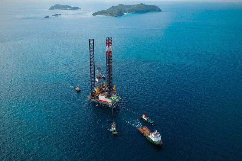
Fortune Business Insights projects that the global offshore drilling market will grow from USD 31.26 billion in 2018 to USD 56.97 billion in 2026, at a CAGR of 7.9% over the forecast period. Rising demand for electricity and the growing importance of offshore oil exploration heavily influence this market growth and drive its expansion.
Hydrographic Survey Market Overview
Despite the increase in popularity, the market for hydrographic surveys is still quite small and has significant competition from other types of surveying. However, market projections indicate that the industry will grow over the next few years. Increasing maritime trade, underwater inspection activities, offshore wind energy projects, offshore oil exploration, and dredging projects across the globe primarily drive this growth.
Key Growth Drivers in the Hydrographic Survey Market
The increase in dredging operations and oil and gas drilling activities is boosting the hydrographic survey market. These activities are increasing in many countries, and a growing number of these activities are being carried out by commercial companies.
The major factors that are boosting the hydrographic survey market include the rising use of unmanned vehicles for surveying and the emergence of new technologies such as machine learning to support complete autonomous operations. These technologies can reduce the cost of operations, while providing high-quality data that is essential for a successful project.
Role and Definition of Hydrographic Surveys
Hydrographic surveys primarily determine the depth of a water body. This technology provides detailed descriptions and measurements of water bodies, which support a variety of projects, including dredging analysis, wreck location, and waterway planning. The process involves the use of multibeam echo sounders and other sonar equipment to survey underwater areas for depth, seafloor shape, and possible obstructions. It is a critical component of any marine activities and helps maintain a safe and efficient execution of a marine project. It is necessary for involved parties of every construction project to know how deep their building area is. Besides, water depth is a key point of knowledge for navigation, inspection, dredging, drilling and other maritime activities.
Applications and Use Cases of Hydrographic Surveys
Local governments and private companies also conduct hydrographic surveys. These entities may carry out surveys for geological reasons, to determine the proper location for oil and gas structures or to install underwater communication devices.
Standards and Guidelines in Hydrographic Surveying
As published in FIG publication No.56, organizations should determine hydrographic survey operations primarily through risk assessment rather than by applying rigid criteria. Organizations can adopt and adapt these Guidelines for the Planning, Execution and Management of Hydrographic Surveys in Ports and Harbours for any hydrographic project, including offshore oil exploration projects.
Project Planning and Risk Assessment Approach
“Before a project kicks off, the project team first assesses the project scope of works and determines the end deliverables, as well as what the client wants to acquire and achieve,” says Gaynor Deacon, Chartered Surveyor and Director at Amaza Survey Services (Pty) Ltd. “Based on the client’s scope of works, the Project Survey Team determines the suite of equipment required to acquire the necessary data and identifies the potential survey team. They then conduct a desktop study to assess any existing hydrographic information, evaluating its quality, reliability, and uncertainties,” she adds.
Key Operational Considerations in Survey Project Planning
Gaynor further particularizes on key points a survey project team will have to determine before a project is awarded or takes shape:-
- how difficult it will be to survey the area (where it is in relation to closest port / can it be surveyed 24hrs day or daylight hours only / any known problems in the area – either environmental (cyclone seasons?), anthropological (e.g. drift nets or local fishing activities) or political/security (local conflicts or piracy risk)
- Type of seabed.
- Expected water depths, safe navigable water depths in relation to the vessel draught and/or towed array.
- Expected vessel traffic for safety and security purposes.
- Expected sea conditions and seasonal weather conditions (which would affect type of vessel and time of year to conduct surveys).
- Accuracy of measured / predicted tides.
Positioning accuracy and source of corrections – e.g. RTK, satellite-based corrections, NTRIP.
Equipment, Methodology, and Survey Execution Planning
“Based on the findings above, the team identifies the type of survey vessel, survey equipment, methodology, and operational approach, and prepares to take the next step once the project is awarded,” says Gaynor.
Importance of Hydrographic Surveys in Dredging and Drilling
Hydrographic surveys are a necessary task for the dredging and drilling industry, because it is impossible to know where a dredge or drilling project will go without a clear picture of the area. Once a team has surveyed the area, it can then begin dredging or drilling accordingly. Another important part of the hydrographic survey process is obtaining accurate GPS positioning. In order to do this, a portable backpack DGPS receiver must be carried by the hydrographer. This allows them to determine the position and extents of objects such as pilings, piers, and other features that are essential for the creation of a survey report.
Government and Institutional Use of Hydrographic Surveys
Many governments and agencies conduct hydrographic surveys for a variety of purposes, including the construction of dredging systems, pipelines, transport navigation, exploration drilling and telecommunication lines. National organizations typically supervise these activities, while local authorities often conduct independent surveys to ensure they accurately depict new developments in the final project report.
More Insights:


