


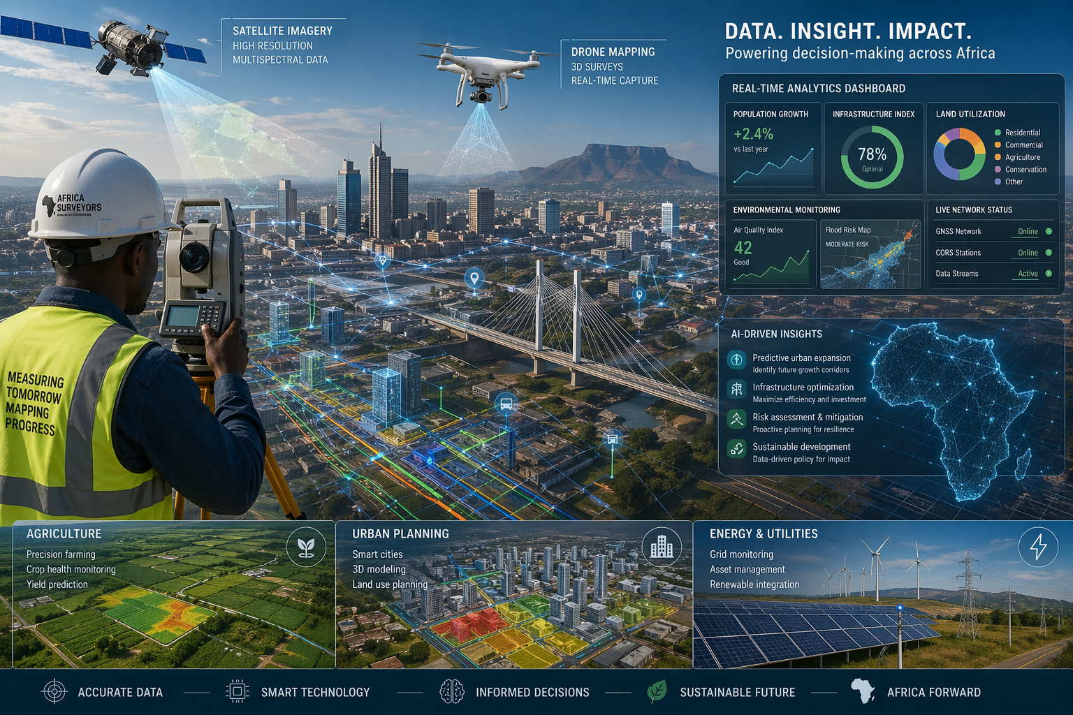
Africa is entering a new era where data, maps, and technology actively shape decision-making. At the center of this transformation lies geospatial intelligence, with the ability to collect, analyze, and use location-based data to solve real-world problems. From smart cities to climate resilience, geospatial intelligence is no longer a niche field. It is becoming a powerful driver of Africa’s development.
A Data-Driven Continent on the Rise
Across Africa, governments, businesses, and development organizations are increasingly relying on geospatial data to guide policies and investments. In particular, location intelligence enables leaders to identify where resources are needed, track population movements, and guide infrastructure development.
Moreover, recent insights show that Africa’s growth depends heavily on how effectively it leverages data and mapping technologies to support planning and decision-making. This shift marks a major transition, from traditional surveying and mapping to dynamic, data-driven systems that deliver real-time insights. Today, geospatial intelligence supports everything from urban planning in major cities to tracking agricultural productivity in rural areas.
The Role of Artificial Intelligence and GeoAI
One of the most transformative forces shaping the future of geospatial intelligence in Africa is artificial intelligence (AI). When combined with Geographic Information Systems (GIS), AI creates what experts call GeoAI, an advanced system that can analyze massive amounts of spatial data quickly and accurately.
AI-powered geospatial tools can now detect patterns, predict risks, and automate mapping processes. For example, machine learning algorithms can analyze satellite imagery to identify land use changes, monitor deforestation, or predict flood risks.
In Africa, where data gaps have historically limited development planning, GeoAI is helping fill those gaps. It allows governments and organizations to generate detailed insights even in areas where traditional data collection has been difficult.
Real-Time Mapping and Smart Decision-Making
The future of geospatial intelligence is not just about collecting data; it is about using it in real time. Advances in mobile technology, cloud computing, and satellite systems are making real-time GIS a reality across Africa.
This means that decision-makers can respond faster to challenges such as natural disasters, disease outbreaks, and urban congestion. In Eastern Africa, for instance, real-time GIS systems are already helping communities prepare for floods and droughts, improving disaster response and saving lives.
As connectivity improves across the continent, real-time geospatial intelligence will become even more powerful. It will enable smarter cities, more efficient transportation systems, and better service delivery in both urban and rural areas.
Driving Key Sectors Across Africa
Geospatial intelligence is not limited to one industry; it cuts across multiple sectors that are critical to Africa’s growth. In agriculture, farmers use satellite data and mapping tools to monitor crops, predict yields, and manage resources more efficiently. On the other hand, the energy sector, companies rely on geospatial data to explore resources and plan infrastructure. In construction and urban development, planners use spatial intelligence to design sustainable cities and infrastructure networks.
Healthcare is also benefiting from geospatial intelligence. By mapping disease patterns and population distribution, governments can improve access to healthcare services and respond more effectively to outbreaks. These applications show that geospatial intelligence is not just a technology, it is a strategic tool for development.
Challenges That Must Be Addressed
Despite its potential, Africa’s geospatial industry still faces several challenges. One of the biggest issues is the lack of high-quality, up-to-date spatial data. In many African countries, data remains fragmented or outdated, limiting its usefulness.
Another challenge is limited awareness and skills. Many organizations still do not fully understand the value of geospatial intelligence or how to use it effectively. This creates a gap between technology availability and actual implementation.
To overcome these challenges, Africa must invest in capacity building, education, and partnerships. Governments, universities, and private companies need to work together to develop skills, improve data infrastructure, and promote innovation.
Collaboration and Policy Will Shape the Future
The future of geospatial intelligence in Africa will depend heavily on collaboration. Regional and international initiatives are already working to create shared standards, improve data access, and promote innovation across the continent.
For example, initiatives led by organizations such as the United Nations aim to strengthen geospatial information management and support data-driven development across Africa.
Strong policies will also play a key role. Governments must create frameworks that encourage data sharing, protect privacy, and support innovation. Without clear policies, the growth of geospatial intelligence may remain uneven across the continent.
The Road Ahead: A Geospatial Revolution
The future of geospatial intelligence in Africa is full of opportunity. Emerging technologies such as digital twins, 3D mapping, and autonomous GIS systems will further transform how spatial data is used.
The integration of AI, cloud computing, and satellite technology will make geospatial tools more accessible and affordable. This will allow even small organizations and communities to benefit from spatial intelligence.
At the same time, Africa’s young and growing population presents a unique advantage. With the right training and investment, the continent can develop a new generation of geospatial professionals who will drive innovation and growth.
Turning Data into Decisive Power
Geospatial intelligence is no longer a supporting tool, it is fast becoming the backbone of Africa’s development strategy. By enabling precise, data-driven decision-making, it is redefining how governments, industries, and communities can manage resources, plan infrastructure, and respond to emerging challenges. From urban expansion to climate resilience, its impact is both immediate and far-reaching.
Although gaps in capacity, funding, and policy alignment persist, accelerating technological adoption and cross-sector collaboration increasingly outweigh them. With sustained investment in skills development, digital infrastructure, and regional partnerships, Africa has a clear opportunity to move from adoption to leadership, positioning geospatial intelligence as a catalyst for sustainable growth, innovation, and long-term resilience across the continent.
More Insights:


