


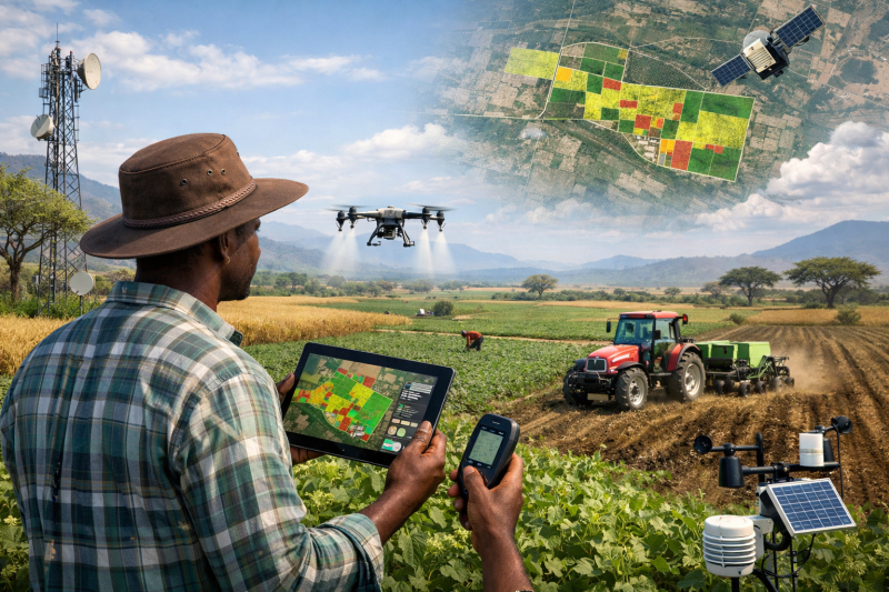
Across Africa, agriculture remains the backbone of many economies, employing millions and feeding growing populations. Yet farmers face persistent challenges, from unpredictable weather and soil degradation to pest outbreaks and limited access to timely information. In this complex landscape, technologies leveraging geospatial data in agriculture are emerging as powerful tools that can reshape how agriculture is practiced, managed, and scaled across the continent.
Geospatial data refers to information that is linked to specific geographic locations. It includes satellite imagery, GPS data, and maps generated through Geographic Information Systems (GIS) and remote sensing technologies. These geospatial data tools are vital in agriculture, as they allow farmers, governments, and agribusinesses to analyze land, climate, and crop conditions in ways that were previously impossible.
A New Era of Precision Farming
One of the most significant ways geospatial data improves agriculture is through precision farming. Instead of treating entire farms uniformly, those utilizing geospatial data in agriculture can now make decisions based on the specific conditions of different areas within their fields.
Satellite imagery and GIS tools can detect variations in soil moisture, nutrient levels, and crop health. This enables farmers to apply fertilizers, water, and pesticides only where needed. Studies show that application of geospatial data in agriculture through these technologies has already helped optimize crop yields by up to 20–30% globally while reducing fertilizer use by around 15%.
This targeted approach not only increases productivity but also lowers costs and minimizes environmental impact, an essential benefit for African countries dealing with resource constraints. Clearly, leveraging geospatial data in agriculture encourages sustainability.
Improving Crop Monitoring and Early Warning Systems
Geospatial data plays a crucial role in monitoring crops and detecting problems early. Through remote sensing, farmers and agricultural agencies can observe vegetation health, identify drought stress, and detect pest infestations before they spread widely. In modern agriculture, geospatial data allows for real-time analysis and improved decision-making.
For example, geospatial models can predict the breeding grounds of destructive pests like desert locusts, allowing governments to act before outbreaks become severe. Early warning systems based on spatial data help safeguard food security by reducing crop losses and improving response times. Moreover, geospatial data in agriculture enhances these warning systems’ effectiveness.
In countries such as Kenya, GIS and remote sensing are already used to analyze agro-climatic conditions and monitor land use changes, supporting better agricultural planning and decision-making. Utilizing geospatial data in agriculture enables targeted interventions and smarter management.
Enhancing Soil and Land Management
Healthy soil is the foundation of productive agriculture. Geospatial data helps farmers understand soil composition, fertility, and erosion patterns across their land. By mapping soil variability, employing geospatial data in agriculture allows farmers to adopt site-specific practices such as crop rotation, conservation tillage, and tailored fertilizer application. This leads to improved soil health and long-term sustainability.
Moreover, spatial analysis allows policymakers to identify areas prone to land degradation or desertification. With this information, governments can implement targeted interventions such as reforestation, irrigation development, or soil conservation programs backed by geospatial data for agriculture.
Supporting Climate-Smart Agriculture
Africa is highly vulnerable to climate change, with increasing temperatures, erratic rainfall, and frequent droughts affecting agricultural output. By utilizing geospatial data in agriculture, climate-smart farming is empowered through provision of accurate and timely information about weather patterns and environmental conditions.
Farmers can use this data to determine the best planting and harvesting times, select suitable crop varieties, and plan irrigation schedules. Spatial datasets that integrate climate, soil, and socio-economic factors allow decision-makers to design policies that are tailored to specific regions—thanks to geospatial data in agriculture.
According to research, integrating GIS and remote sensing into agricultural planning improves evidence-based decision-making and strengthens resilience to climate risks. This makes geospatial data in agriculture essential for future-proofing the sector.
Enabling Better Policy and Investment Decisions
Beyond the farm level, geospatial data plays a critical role in shaping agricultural policy and investment strategies. Governments and development organizations use spatial datasets to identify priority areas, allocate resources, and monitor the impact of interventions. Ultimately, geospatial data in agriculture informs long-term planning.
Large-scale geospatial databases, such as those developed for sub-Saharan Africa, combine data on agricultural production, infrastructure, and socio-economic conditions. These datasets help decision-makers understand regional differences and design targeted programs that address specific challenges. For agriculture, geospatial is invaluable in shaping these solutions.
For example, policymakers can use geospatial analysis to determine where irrigation infrastructure is most needed or which regions would benefit from improved road access to markets, further demonstrating the impact of geospatial data in agriculture.
Empowering Smallholder Farmers
While large-scale farms often adopt advanced technologies quickly, the real transformative potential of geospatial data in Africa lies in its ability to empower smallholder farmers. As geospatial data becomes more accessible, smaller operations benefit greatly in agriculture.
Mobile-based platforms and user-friendly applications now deliver geospatial insights directly to farmers. These tools translate complex data into simple recommendations, such as where crops are under stress or how much fertilizer to apply. Indeed, geospatial data in agriculture has increased efficacy and reach for smallholders.
As one developer noted in a recent discussion on GIS-based farming tools, farmers respond best when data answers practical questions like “where is the problem” and “how bad is it.” This highlights the importance of making geospatial technology accessible and actionable for everyday users across agriculture, using geospatial data effectively.
Challenges to Adoption
Despite its potential, the adoption of geospatial technology in African agriculture faces several challenges. These include limited access to high-quality data, lack of technical skills, and inadequate infrastructure. Sometimes, geospatial analysis in agriculture is hindered by connectivity issues.
Many rural areas still struggle with poor internet connectivity, which limits the use of digital tools. Additionally, there is a need for training programs to build capacity among farmers, extension officers, and policymakers interested in geospatial for agriculture.
However, ongoing advancements in open data platforms, cloud computing, and mobile technology are gradually reducing these barriers. As awareness grows, more stakeholders are recognizing the value gained from geospatial data in agriculture.
Transform African Farming Systems
The future of African agriculture will increasingly depend on data-driven decision-making. Geospatial technology offers a pathway to more efficient, resilient, and sustainable farming systems. As geospatial data in agriculture continues to grow in prominence, transformation will accelerate.
With continued investment in data infrastructure, education, and innovation, African countries can unlock the full potential of geospatial data. This will not only improve agricultural productivity but also enhance food security and economic growth across the continent through innovative geospatial data in agriculture.
Read More:


